Lake Facts
| Mill Pond | |
|---|---|
| DNR ID/ Becker No | MN 03-377-00/377 |
| Township(s) | Lake View |
| Lake Classification | Natural Environment |
| Ordinary High-Waterline (OHW) | (NGVD29) |
| Size | 185.6 Acres |
| Maximum Depth | 10 ft. |
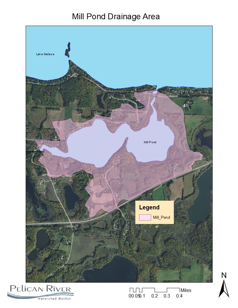
| Watershed Area | 481 Acres |
| Impairment Listings | None listed |
| Common Fish Species | Black Crappie, Bluegill, Green Sunfish, Largemouth Bass, Northern Pike, Walleye |
| Invasive Species | Flowering Rush, Zebra Mussels |
| Public Access/Beaches | none |
| Land Use | 29.4% Open Water 15.4% Developed 2.0% Wetlands 14.6% Cultivated Crops 23.0% Forest 27.9% Grassland |
Map

Lake Description & Overview
Mill Pond is a shallow natural environment lake. Technically, Mill is a reservoir because of a downstream dam (Bucks Mill Dam) which maintains the water level about 6 feet above the natural lake elevation. The east half of the lake is densely vegetated except for the channel where the Pelican River flows through. The west basin contains open water and reaches a maximum depth of 10 feet.
Mill has no designated boat ramp, but the lake can be accessed via Lake Melissa with canoes, kayaks, or small watercraft. There are some single family homes, primarily in the west basin.
Historically, a dam located downstream from where the current dam exists, was used to provide water power for the adjacent mill. This dam has been removed, however, the original dam embankments where the water wheel would have been, remain intact. The current dam sits approximately 100 feet upstream from the historic location and is used to control water levels on Mill Pond, which is used as a MN DNR rearing pond.
In 2019, Becker County and the MN DNR began discussions of possibly removing the outlet structure and replacing it with a rock weir rapids. The District is concerned the removal of the dam will allow for passage of common carp, which are a nuisance species and will cause ecological harm.
Water quality was monitored for a three-year period from 2007-2009, with total phosphorus levels at 20ppm and water clarity at 7.5 ft. The nutrient levels were found to be very similar to Lake Mellissa, which drains through Mill Pond.
Due to its connection to Lake Melissa, the lake is also infested with Zebra Mussels and Flowering Rush. In past years, the Pelican Group of Lakes Improvement District (PGLID) has managed Flowering Rush in Mill Lake by chemical and hand removal in an attempt to minimize propagation to downstream lakes (Pelican Lake).
Water Quality
Mill Pond
Learn More
DNR Lakefinder
Get information on water levels, fish stocking, and water clarity for Mill Pond.
MPCA Surface Water Data
Find historical lake and stream water quality data for Mill Pond.
Becker County Coalition of Lake Associations
.
Goals
Short Term Goals – Year 2025
- Maintain a 5-year mean summer phosphorus concentration at or below 20 μg/L ± 4%
- Maintain mean summer Secchi depth no less than 5 ft
Long Range Goals – Year 2035
- Maintain a 5-year mean summer phosphorus concentration at or below 20 μg/L ± 4%
- Maintain mean summer Secchi depth no less than 5 ft
Studies & Surveys
Future Surveys as part of 2020-2030 Monitoring Plan
Water Quality- 2028
Vegetation Survey – 2027
Past Surveys
Water Quality – 2007-2009, 2023
Shoreline Survey – 2011
Vegetation Survey – 2022
For more studies and surveys, see the Detroit-Rice Water Management Area.

