
Lake Facts
| Munson | |
|---|---|
| DNR ID/ Becker No | MN 03035700 |
| Township(s) | Lake View |
| Lake Classification | Rural Development |
| Ordinary High-Waterline (OHW) | 1333.99 (NGVD29) |
| Size | 133.83 Acres |
| Maximum Depth | 26 ft. |
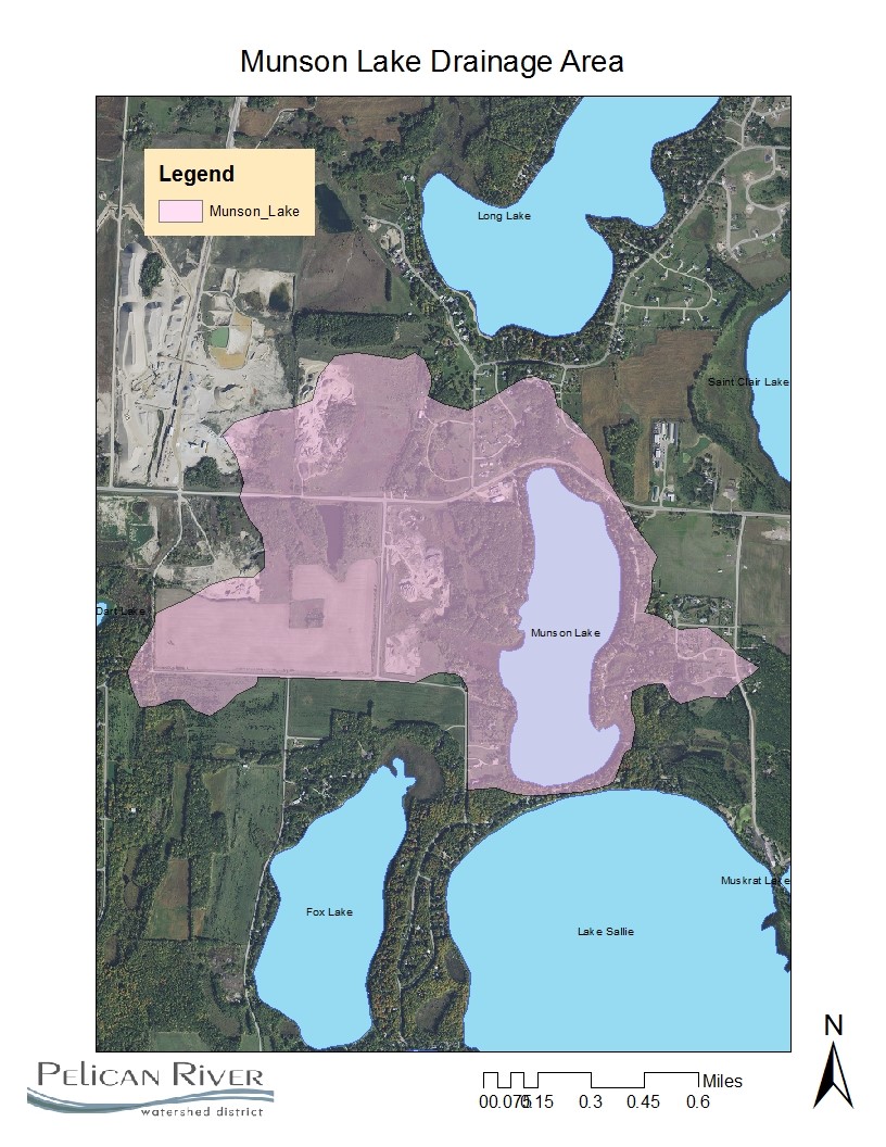
| Watershed Area | 748 Acres |
| Impairment Listings | None listed |
| Common Fish Species | Black Crappie, Bluegill, Bluegill, Largemouth Bass, Northern Pike, Walleye |
| Invasive Species | None listed |
| Public Access/Beaches | none |
| Land Use | 17.9% Open Water 14.9% Developed 3.7% Wetlands 25.2% Cultivated Crops 25.6% Forest 12.8% Grassland |
Map
Lake Description & Overview
Munson lake is recreational development lake with a heavily developed shoreline, located just southeast of the City of Detroit Lakes, between Long Lake and Lake Sallie. Munson Lake has a littoral area of approximately 48 acres (36% of lake surface area). There are no surface water inlets and the lake receives water primarily from stormwater runoff and groundwater interaction. Water flows from the lake on the southeast corner through a series of historic MN DNR fisheries rearing ponds to Lake Sallie. A MN DNR public access constructed of gravel is located near the outlet.
The shoreline topography is predominantly steep slopes with bluffs draining toward the lake. During early development of these areas, wood retaining walls were used to alter the slope topography to allow building construction closer to the lake. In many locations, the wood walls have begun to fail and need to be removed and the slope stabilized with vegetation. In some cases, when removal is not feasible, the walls must be properly replaced. The shoreline survey conducted in 2017, revealed 23 parcels containing retaining walls.
Munson is classified as a mesotrophic lake with good water quality that supports a healthy fishery and allows many types of recreational uses. Munson is dimictic,mixing in the spring and in the fall, remaining well mixed in the upper 5-6 meters (16.5-19.5 feet). Water quality on Munson has been stable for the last 10 years with the exception of total phosphorus level, which showed a 20% improvement from the previous ten-year period (1998-2007). Water clarity averages are nearly 11 feet with total phosphorus levels of 18ppb.
Because of Munson’s elongated shape, it has a higher shoreline length to lake area ratio. This allows more residential development and increased developmental pressure than a lake similar to its size with a round shape. Developmental pressure was apparent during a survey of shoreline alteration where 52% of the parcels were found to be greatly or moderately altered. Only 24% of the parcels were in a natural condition.
Two gravel mining operations are located in the western portion of the drainage area.
Water Quality
Munson Lake
Learn More
DNR Lakefinder
Get information on water levels, fish stocking, and water clarity for Munson.
MPCA Surface Water Data
Find historical lake and stream water quality data on Munson.
Goals
Short Term Goals – Year 2025
- Maintain a 5-year mean summer phosphorus concentration at or below 20 μg/L ± 4%
- Maintain mean summer Secchi depth no less than 10 ft
Long Range Goals – Year 2035
- Maintain a 5-year mean summer phosphorus concentration at or below 20 μg/L ± 4%
- Maintain mean summer Secchi depth no less than 10 ft
Studies & Surveys
Future Surveys as part of 2020-2030 Monitoring Plan
Water Quality- 2024 & 2029
Vegetation Survey – 2028
Shoreline Survey – 2029
Past Surveys
Water Quality – 1995, 1998-2002, 2004-2006, 2009, 2010, 2013-2015, 2017, 2019.
Shoreline Survey – 1998, 2004, 2009, 2019
Vegetation Survey – 2011, 2018
For more studies and surveys, see the Fox-Munson Water Management Area.