
Lake Facts
| St. Clair | |
|---|---|
| DNR ID/ Becker No | MN 03-0382-00/382 |
| Township(s) | Lakeview, Detroit |
| Lake Classification | Natural Environment |
| Ordinary High-Waterline (OHW) | 1337.5 (NGVD29) |
| Size | 142 Acres |
| Maximum Depth | 7.5 ft. |
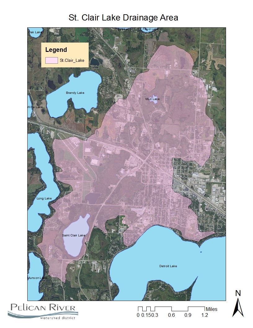
| Watershed Area | 4430 acres |
| Impairment Listings | Nutrients |
| Common Fish Species | unknown |
| Invasive Species | Curly Leaf Pondweed |
| Public Access/Beaches | None |
| Land Use | 4.7% Open Water 40.8% Developed 15% Wetlands 12.7% Cultivated Crops 11.9% Forest 14.9% Grassland |
Map
Lake Description & Overview
Originally, Lake St. Clair was a 591 acre lake located west of the Detroit Lakes. In about 1915, the lake was drained to its present size of 140 acres because of the “awful stench” it presented to the local residents. This was caused by more than seventy years of untreated sewage from the City of Detroit lakes. A modern sewage treatment plant was constructed in 1976 which reduced phosphorus loadings to St. Clair by approximately 90%. The City continues to discharge treated effluent wastewater on the north side of the lake.
St. Clair is prone to annual winterkill episodes and therefore does not support game fish populations. There is no public access on the lake. The lake is, however, heavily used by waterfowl.
Two ditches bring water to St. Clair, including much of the City of Detroit Lakes stormwater runoff. A natural outlet from Long Lake enters from the west, which contributes only minor amounts of water and nutrient load. St. Clair discharges to the southwest via Ditch 14 to the Pelican River, entering Muskrat and Sallie Lakes. Ditch 14 flows through a partially drained wetland which contributes additional phosphorus prior to outlet to the Pelican River.
Lake bottom sediments are up to 16 feet thick in portions of the lake and are thought to be caused by the lake’s history of receiving sewage prior to modern wastewater treatment.
The Pelican River Watershed District applied aluminum sulfate (ALUM) to Lake St. Clair in October 1998. This treatment was a phased approach intended to reduce the unacceptable phosphorus level in Lake Sallie. Following the ALUM treatment, in-lake phosphorus concentrations in St. Clair Lake were reduced by over 50% from 131ppb to 72ppb, with a similar reduction in orthophosphate. Phosphorus level began to trend upward beginning in the early 2010’s showing that the ALUM treatments effectiveness had begun to wear and that another dose will be required to maintain phosphorus level below 80ppb.
In 2016, the MPCA accepted the St. Clair lake Total Maximum Daily Load (TMDL) study. The study showed that the lake is capable of a daily loading capacity of 2.75 lbs.of phosphorus a day. This equates to a 24% reduction of the current load. The TMDL report allowed for an increase in nutrient load for the City of Detroit Lakes Wastewater Treatment Facility by 95 lbs/yr, a 28% increase to allow for population growth and annexation within the city. To meet the reduction goal, the total reduction of phosphorus in non-point sources (stormwater runoff from within the City of Detroit Lakes) is 277 lb/yr, and 49% decrease from the existing condition.
Water Quality
Learn More
DNR Lakefinder
Get information on water levels, fish stocking, and water clarity for St. Clair.
MPCA Surface Water Data
Find historical lake and stream water quality data for St. Clair.
Goals
Short Term Goals – Year 2025
- Maintain a 5-year mean summer phosphorus concentration at or below 60 μg/L
- Maintain mean summer Secchi depth no less than 3.5 ft
Long Range Goals – Year 2035
- Maintain a 5-year mean summer phosphorus concentration at or below 60 μg/L
- Maintain mean summer Secchi depth no less than 3.5 ft
Studies & Surveys
Future Surveys as part of 2020-2030 Monitoring Plan
Water Quality- 2020-2030 (all years)
Past Surveys
Water Quality – 1998-2002, 2004-20010, 2012-2023
Vegetation Survey – (MN DNR) 2015
For more studies and surveys, see the Sallie-Melissa Water Management Area.