
Lake Facts
| Sands | |
|---|---|
| DNR ID/ Becker No | MN 03-0420-00/420 |
| Township(s) | Richwood |
| Lake Classification | Natural Environment |
| Ordinary High-Waterline (OHW) | Not recorded (NGVD29) |
| Size | 104.7 Acres |
| Maximum Depth | 11 ft. |
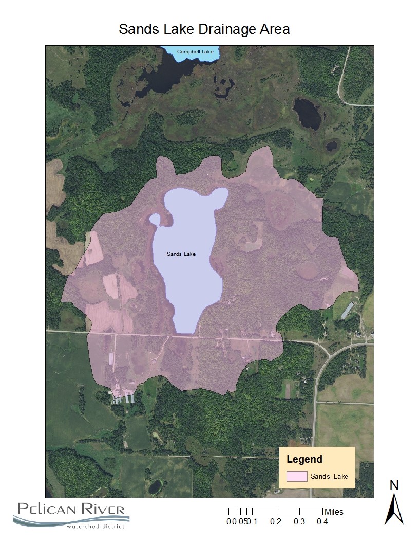
| Watershed Area | 545 Acres |
| Impairment Listings | none listed |
| Common Fish Species | unknown |
| Invasive Species | None listed |
| Public Access/Beaches | None |
| Land Use | 17.4% Open Water 4.8% Developed 6.7% Wetlands 4.3% Cultivated Crops 51.2% Forest 15.5% Grassland |
Map
Lake Description & Overview
Sand Lake is a shallow natural environment lake located 1.5 miles north of Floyd Lake and about 6 miles north of the City of Detroit Lakes. There is very little residential development on the lake with only three residential single-family homes located in the very southern portion of the lake. Sands has a prominent wetland fringe along the edge of the lake and it is land locked with no significant surface water inlet or outlet. The lake is recharged by stormwater runoff and groundwater interactions.
Sand Lake was monitored for chemistry and clarity from 2006-2010 with average water clarity of 9.5 feet and mean summer total phosphorus levels of 30 ppb. Macrophyte growth is present throughout the lake, and is especially dense in water less that 5-feet.
Water Quality
Sands
Learn More
DNR Lakefinder
Get information on water levels, fish stocking, and water clarity for Sands.
MPCA Surface Water Data
Find historical lake and stream water quality data for Sands.
Goals
Short Term Goals – Year 2025
- Maintain a 5-year mean summer phosphorus concentration at or below 30 μg/L ± 4%
- Maintain mean summer Secchi depth no less than 10 ft
Long Range Goals – Year 2035
- Maintain a 5-year mean summer phosphorus concentration at or below 30 μg/L ± 4%
- Maintain mean summer Secchi depth no less than 10 ft
Studies & Surveys
Future Surveys as part of 2020-2030 Monitoring Plan
Water Quality- 2022-2027
Shoreline Survey – 2020, 2025
Past Surveys
Water Quality – 2006, 2007, 2009, 2010
Shoreline Survey – 2006, 2011, 2020
For more studies and surveys, see the Floyd-Campbell Water Management Area.