
Characteristics
| Campbell/Whiskey Creek (Ditch 11/12) | |
|---|---|
| Segments | Whiskey Creek/Ditch 11 Campbell Creek/Ditch 12 |
| Waterbody ID | 09020103-543 Campbell Creek, Campbell Lk to Floyd Lk |
| Length | Whiskey Creek - 3.79 miles Campbell Creek - 3.77 miles |
| Elevation Change | Whiskey Creek - 45 ft Campbell Creek - 65ft |
| Headwaters | Whiskey Creek- Moon Lake Campbell Creek - Campbell Lake |
| Outlet | Whiskey Creek - Campbell Lake Campbell Creek - North Floyd Lake |
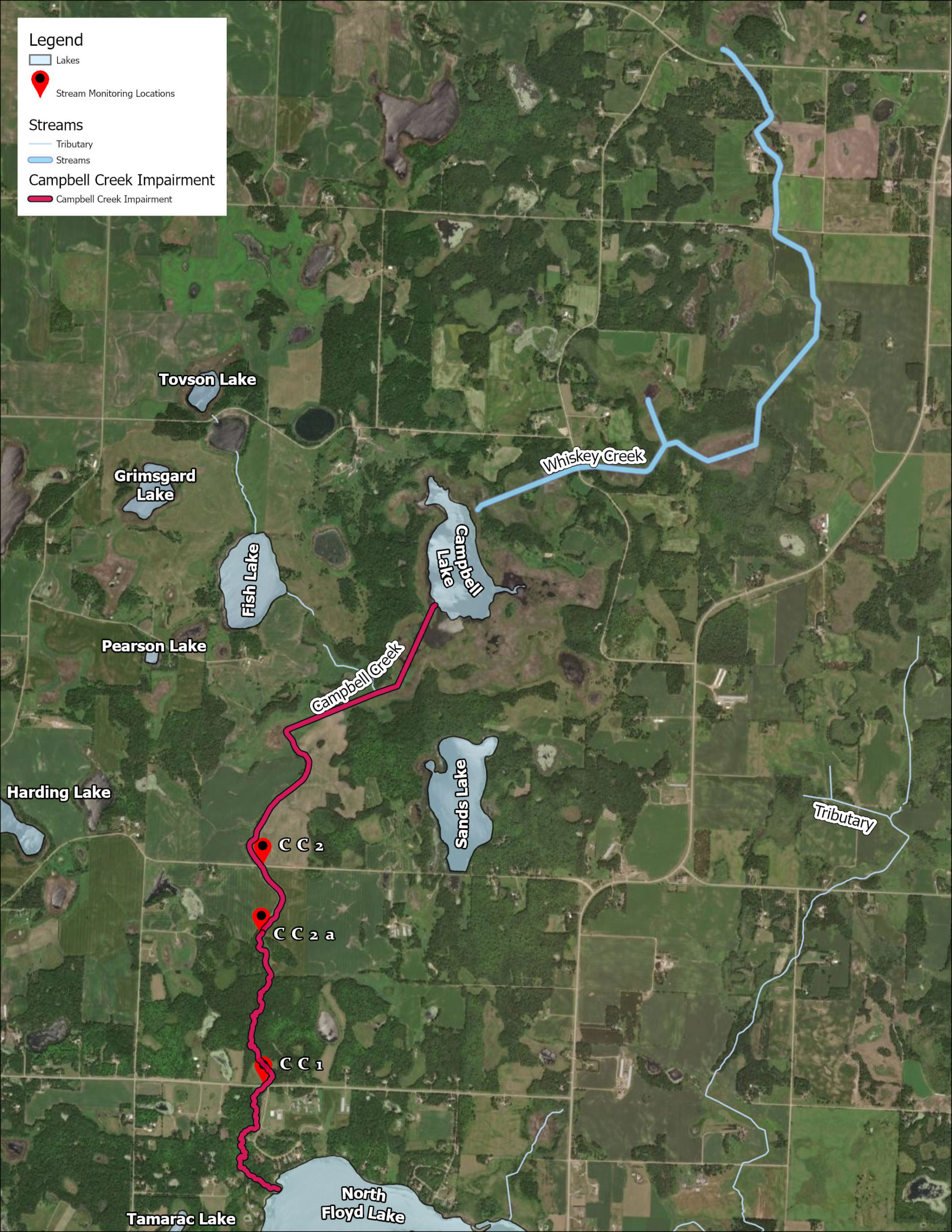
| Number of Sampling Sites | 3 Sites: S002-164- Campbell Creek at 230th St S015-108- Campbell Creek 1 Mi south of 230th St S002-163- Campbell Creek at CSAH 149 |
| Impaired (On the MPCA Impaired Waters List, Restoration necessary) |
Sediment (TSS) |
| Enhance (Enhance condition to prevent future impairment. Nearly Impaired/degrading trend.) |
Dissolved Oxygen, Total Phosphorous |
| Protect (maintain good condition and protect against future risks) |
N/A |
Map
Description & Overview
Becker County Ditch 11, also known as Whiskey Creek, flows from historic Moon Lake south through several wetland areas to Campbell Lake. From Campbell Lake, water flows into Becker County Ditch 12 where it flows into Campbell Creek about 1.5 miles south of Campbell Lake. Campbell Creek carries the water through a natural segment of stream the rest of the way to Floyd Lake.
Although Campbell Creek is technically on the unmodified stream section downstream of Ditch 12, much of the system is often referred to as Campbell Creek, including Whiskey Creek/Ditch 11. Historically, Campbell Creek would have flowed from Campbell Lake to North Floyd Lake, but sections of Campbell Creek were ditched and straightened in the early 1900s for agricultural benefit and to draw down Campbell Lake and surrounding wetland areas. The same rings true for Whiskey Creek. Ditch 11 was also constructed to improve agricultural lands and draw down Moon Lake to the North.
Campbell Creek is an intermittent, high gradient stream and is the major nutrient source to North Floyd Lake. Campbell Creek drops almost 70 feet in 4 miles before reaching North Floyd. Through the lower reach, Campbell Creek flows through highly erodible soils, and carries a heavy sediment load to North Floyd. A new impairment from high sediment loads was listed through the 2021 Ottertail WRAPS
Flows in Campbell Creek tend to be flashy and largely driven by surface runoff. Extensive agriculture (row crops and livestock grazing) exists in the upland areas. In the early 2010’s, PRWD partnered with Becker SWCD and NRCS to install several agricultural BMP’s to decrease sediment coming from the row crop land between Campbell Lake and North Floyd Lake. Extensive conservation work includes ditch buffers, water and sediment control basins (WASCoB’s), and wetland restorations. These practices have decreased loads of sediment and phosphorous to Campbell Creek, but other issues still need to be addressed (e.g., drain tile and stream bank erosion).
Water Quality
Total Phosphorus and Discharge
Total Suspended Solids and Discharge
Annual Sediment Load (tons/yr)
Learn More
DNR Streams
Get information on streams and rivers in Minnesota here.
MPCA Surface Water Data
Find historical water quality data for streams throughout the Pelican River Watershed District and the State of Minnesota here
Goals
Under Construction
Studies & Surveys
For surveys and studies on Campbell Creek, see the Resource Library.