
Characteristics
| Pelican River (Ditch 13) | |
|---|---|
| Waterbody ID | 09020103-771 Headwaters to HWY 10 09020103-772 HWY 10 to Detroit LK |
| Length | 5.88 Miles |
| Elevation Change | 20ft |
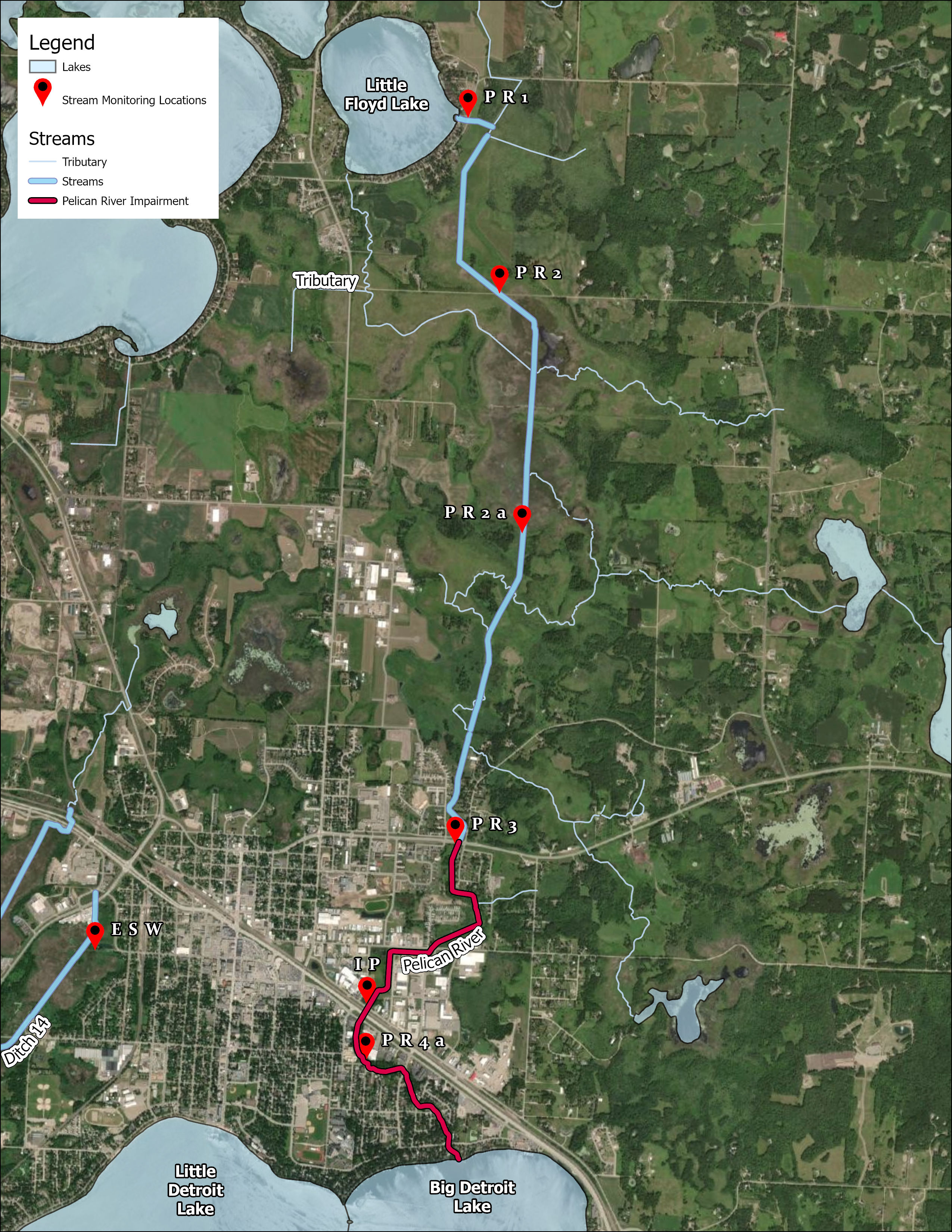
| Headwaters | Little Floyd Lake |
| Outlet | Big Detroit Lake |
| Number of Sampling Sites | 6 Sites: S002-167 - Outlet of Little Floyd Lake S002-168 - (Historic) Anchor Rd S002-178 - Outlet of Rice Lake S002-169 - HWY 34 S015-007 - HWY 10 S002-176 - Near Long Ave |
| Impaired (On the MPCA Impaired Waters List, Restoration necessary) |
E. Coli; Low Dissolved Oxygen; Aquatic Invertebrate Bioassessments; Fish Bioassessments |
| Enhance (Enhance condition to prevent future impairment. Nearly Impaired/degrading trend.) |
Dissolved Oxygen, Total Phosphorous |
| Protect (maintain good condition and protect against future risks) |
Total Suspended Solids (sediment) |
Map
Description & Overview
The Pelican River originates at Little Floyd Lake on the boundary of the Detroit Rice WMA. Also known as Ditch 13, the Pelican River flows south through the Rice Lake Wetland Complex, through the City of Detroit Lakes, before entering Big Detroit Lake on the North Shore. The Pelican river stretches 6 miles between Little Floyd Lake and Detroit Lake, only loosing 20ft of elevation. As the river flows through the Rice Lake Wetland Complex, it picks up heavy loads of phosphorous which it carries to Detroit Lake. The District is planning a restoration project to limit loading from the Rice Lake Wetland.
The historic headwater of the Pelican River was on the South end of Little Floyd Lake where the current DNR public access is. In the early 1900’s, Ditch 13 was created through the Rice Lake Wetland and moved the headwaters to its current location on the east shore of Little Floyd Lake. The Historic Pelican River channel is now a wetland area with no water flow. Ditching through the Rice Lake wetland causes phosphorous release from the wetland during heavy rain events through a flushing process. By completing the Rice Lake Wetland Restoration, water levels will be stabilized and flushing will be controlled.
The impairments on the Pelican River are related to a lack of structure in the stream channel and E.coli runoff from an unknown source. After E.coli populations bloom, the organisms die and uses a large amount of dissolved oxygen as they decompose. This combined with no aeration from natural riffles and no habitat from natural snags and structure makes the Pelican River an inhospitable place for aquatic organisms. Restoration of the stream channel through the City of Detroit Lakes may help to increase habitat, dissolved oxygen, and aquatic organism populations.
Water Quality
Total Phosphorus and Discharge
E. Coli and Discharge
Total Suspended Solids and Discharge
Annual Phosphorus Load (lbs/yr)
Annual Sediment Load (tons/yr)
Learn More
DNR Streams
Get information on streams and rivers in Minnesota here.
MPCA Surface Water Data
Find historical water quality data for streams throughout the Pelican River Watershed District and the State of Minnesota here
MPCA Watershed Information
Find information on the Otter Tail River Watershed here.
Goals
Under Construction
Studies & Surveys
For surveys and studies on the Pelican River, see the Resource Library.