
Characteristics
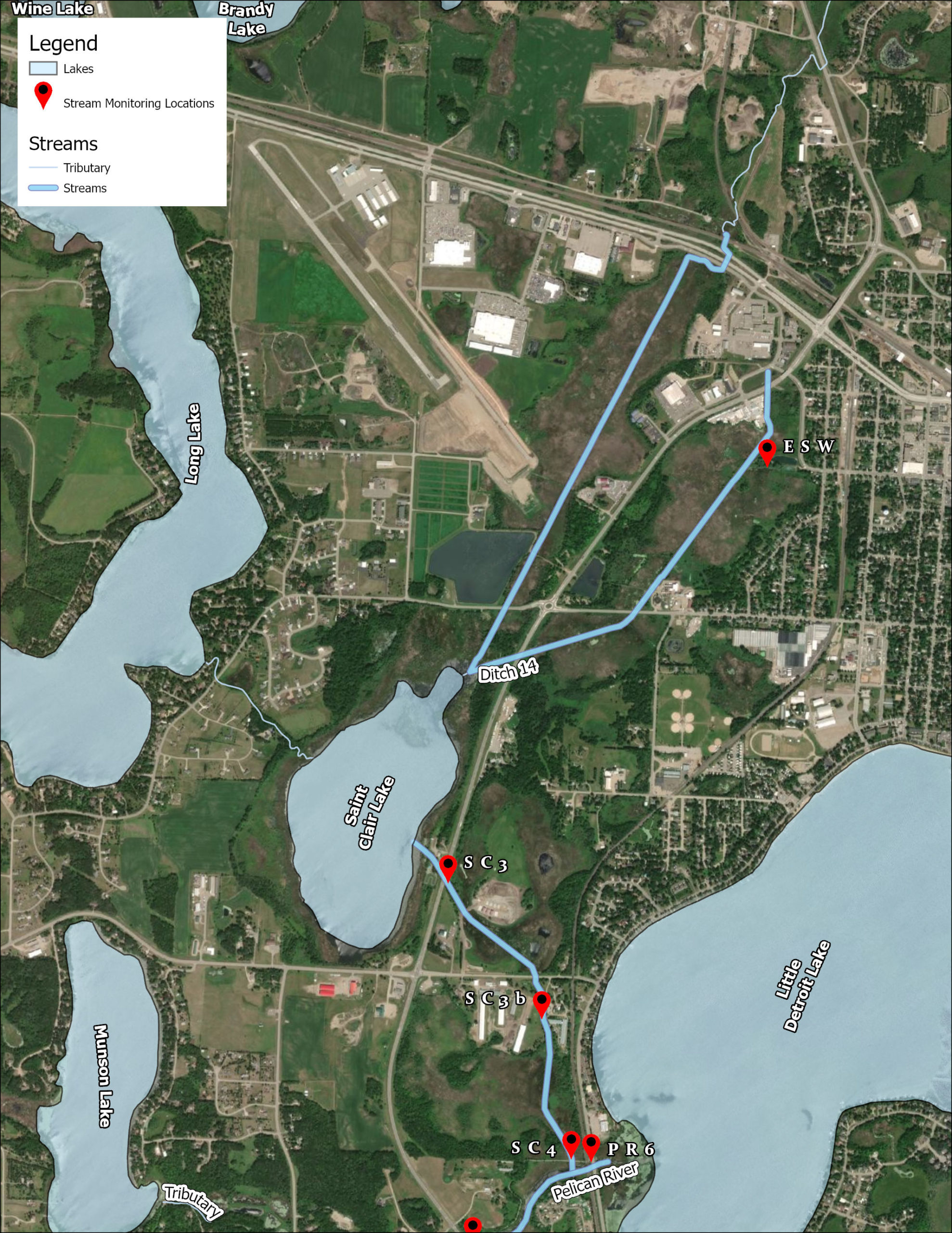
| Ditch 14 (St. Clair Creek) | |
|---|---|
| Length | 3.87 mi |
| Elevation Change | 6 ft |
| Headwaters | St. Clair Lake (and adjacent wetlands) |
| Outlet | Pelican River |
| Number of Sampling Sites | 3 Sites: S002-158 - HWY 59 S002-247 - County HWY 6 S002-160 - Outlet to Pelican River |
| Impaired (On the MPCA Impaired Waters List, Restoration necessary) |
N/A |
| Enhance (Enhance condition to prevent future impairment. Nearly Impaired/degrading trend.) |
Total Phosphorous, Dissolved Oxygen |
| Protect (maintain good condition and protect against future risks) |
Total Suspended Solids (Sediment) |
Map
Description & Overview
Originally, Lake St. Clair was a 591 acre lake located west of the Detroit Lakes. In about 1915, the lake was drained to its present size of 140 acres because of the “awful stench” it presented to the local residents. Ditch 14 is the ditch dug to drain Lake St. Clair. Ditch 14 brings water to St. Clair, including much of the City of Detroit Lakes Stormwater runoff. St. Clair discharges to the southwest via Ditch 14 to the Pelican River, entering Muskrat and Sallie Lakes. Ditch 14 flows through a partially drained wetland which contributes additional phosphorus prior to outlet to the Pelican River.
Ditch 14 receives the heavy phosphorous loads from Lake St. Clair that caused the Impairment identified in 2016. It also increases its phosphorous load through the wetlands between Lake St. Clair and the Pelican River.
Water Quality
Learn More
DNR Streams
Get information on streams and rivers in Minnesota here.
MPCA Surface Water Data
Find historical water quality data for streams throughout the Pelican River Watershed District and the State of Minnesota here
MPCA Watershed Information
Find information on the Otter Tail River Watershed here.
Goals
Under Construction
Studies & Surveys
For surveys and studies on Ditch 14, see the Resource Library.