
PRWD’s Board of Managers Promotes Shanna Bach to Administrator

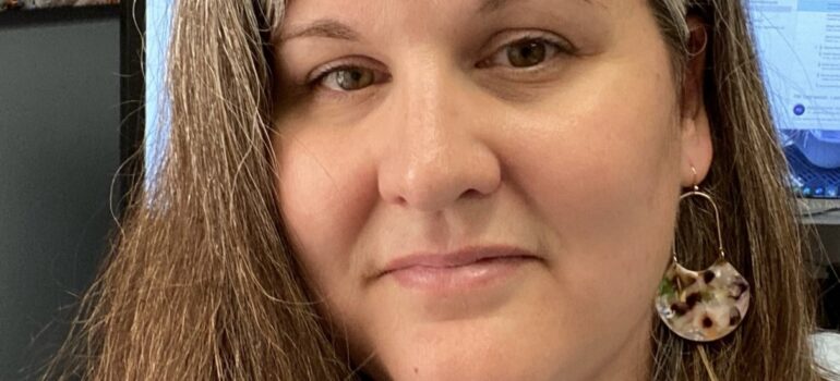
At the October 21, 2026, Regular Meeting of the Board of Managers, the Board promoted Shanna Bach to serve as Administrator of the Pelican River Watershed District.

Meet Shanna Bach, PRWD’s New Watershed Administrator

For Shanna Bach, protecting the lakes and outdoor spaces of the Pelican River Watershed is more than a profession. It’s personal.

An avid angler, boater, paddleboarder and hiker, Shanna has spent much of her life drawn to the water. Now, as the newly appointed Watershed Administrator for the Pelican River Watershed District, she brings together a lifelong passion for the outdoors with experience in science, quality assurance, project management, public finance and community service.

And while her appointment marks a new chapter for the District, Shanna is far from new to the work. She joined the PRWD in 2024 as Office Coordinator and stepped into the interim administrator position in the spring of 2026.

“For the last several months, Shanna has been our interim administrator. She not only performed her duties at a high level but also continued as our office manager, doing the public outreach and spearheading a tornado cleanup [on Big Floyd Lake],” said Rick Michaelson, Pelican River Watershed District Board President. “Our entire Board is excited to have a great administrator and very confident with the skills that Shanna has displayed.”

A Lifelong Connection to the Water

Shanna grew up in Hazen, North Dakota, where summers were spent exploring Lake Sakakawea and canoeing the Knife and Missouri rivers. Her interest in the natural world eventually led her to Minnesota State University Moorhead, where she earned bachelor’s degrees in biology and chemistry.

After college, she worked for SurModics in the Twin Cities, specializing in the validation of safety-control methods related to sterility and biocompatibility. Away from work, Shanna and her husband, Eric, spent much of their free time fishing and boating around Lake Minnetonka.

In 2004, the family relocated to Fargo, where Shanna joined the then-small biotechnology company Aldevron as Quality Assurance Manager. Even from Fargo, the lakes continued to call, and she regularly made the trip along Highway 10 to fish and recreate on Becker County lakes.

Making Lake Life Home

Lake life had always been the dream, and in 2013, the Bach family made it a reality, moving to Little Cormorant Lake south of Audubon.

Wanting to be more available to her children, Shanna entered public service at Lake Park Audubon Schools. She started as a paraprofessional and eventually moved into the business office, where she gained experience in public fund accounting.

She also became deeply involved in her community.

Shanna volunteers at Saint Peter’s Church in Audubon, teaches Sunday School and helps stream church services. At Lake Park Audubon Schools, she leads the Friends of the Fine Arts group, helps with the theater department and coaches LPA’s Archery Team.

Those roles reflect just how deeply connected Shanna is to her community, not only as a resident, but as an active participant in the people, activities and places that make it home.

A Passion for the Work and a Commitment to Carry It Forward

In 2024, Shanna found an opportunity to bring her professional experience and love for the outdoors together when she originally joined the PRWD.

“This is a dream job for me,” Shanna said in 2024 when she joined the organization. “I get to bring my skill set and work with it to protect and enhance our lakes. Outdoor spaces are something that I’m incredibly passionate about and give me so much peace and joy in my own life.”

Her new appointment as Watershed Administrator follows the passing of former Administrator Tera Guetter. Shanna steps into the role with deep respect for Tera’s leadership and a desire to carry that work forward.

“I am most excited to continue former Administrator Tera Guetter’s work with capital projects in the District,” Shanna said. “Watershed Districts have a unique ability to get large-scale projects funded and executed for the waters we care for.”

“In 2026, we worked in the headwaters on Campbell Creek, in the middle of the District on the Rice Lake Wetland, and at the very end of the District with Buck’s Mill,” she continued. “I will do my best to continue Tera’s legacy of stewarding water quality improvement projects for the District.”

Those projects demonstrate the breadth of the District’s work. At Campbell Creek, efforts are focused on addressing sediment and nutrient pollution flowing toward North Floyd Lake. The Rice Lake Wetland restoration is intended to further reduce phosphorus loading into Detroit Lake. And the recently completed Buck’s Mill Dam Modification includes a natural-looking spillway designed to allow fish passage along the Pelican River.

A Public Servant and a Neighbor

For Shanna, serving as Watershed Administrator isn’t only about managing projects. It’s about listening to the people who know and care about these waters.

“I want people to know that I take my role as a public servant seriously,” Shanna said. “The whole reason I am here is to serve the public on matters of water quality in our District. I love talking to people and learning from their experiences.”

She also recognizes the value of knowledge built over generations.

“There are people in this community that have been here a lot longer than I have, and their perspectives are so important to the work we do,” Shanna said. “I welcome your questions and comments.”

That approach fits someone whose own connection to the watershed has grown through years of living, working, volunteering and raising a family here.

Shanna and her husband Eric continue to spend as much time outdoors as they can. Along with their two daughters and lab-mix, Mako, the family enjoys fishing, boating, paddleboarding and exploring trails throughout Becker and Otter Tail counties.

Her new role brings her story full circle, combining her background in science and public service with a lifelong connection to the water. As Watershed Administrator, Shanna is ready to put that experience and passion to work for the Pelican River Watershed and the community she calls home.

Read More

Protecting Our Lakes Starts with Prevention – Understanding Aquatic Invasive Species

The lakes of the Pelican River Watershed are more than places to fish, swim, and enjoy time outdoors. They are connected ecosystems that support native plants, wildlife, and the communities that surround them. Protecting these waters means addressing many different challenges, from runoff and development impacts to emerging threats like aquatic invasive species.

Aquatic invasive species, often called AIS, are plants, animals, or other organisms that are not naturally found in a waterbody and can cause harm when introduced. Once established, these species can be difficult and expensive to manage. Preventing their spread is one of the most effective ways residents and visitors can help protect the lakes they love.

What Are Aquatic Invasive Species?

Minnesota is home to thousands of lakes, making it a destination for boating, fishing, and water recreation. These activities connect people with the outdoors, but they can also unintentionally move invasive species from one lake to another.

AIS can spread when small pieces of plants, microscopic organisms, or animals are transported on boats, trailers, fishing equipment, docks, and other gear. A single boat moving between lakes without proper cleaning can introduce a species that may take years of monitoring and management to control.

Unlike native species that have evolved within local ecosystems, invasive species often lack natural predators or other environmental controls. This allows them to grow quickly, compete with native plants and animals, and change the balance of an entire aquatic system.

AIS Challenges in the Pelican River Watershed

Since the early 2000s, PRWD has been actively monitoring and managing aquatic invasive species throughout the watershed. Current AIS management efforts have focused on species including curly-leaf pondweed and flowering rush, two invasive aquatic plants that can impact recreation, navigation, and native plant communities.

Addressing AIS requires more than a single treatment or project. PRWD uses research, monitoring, partnerships, and targeted management strategies to better understand where invasive species are located and determine the most effective ways to respond. Recent research efforts have included evaluating treatment approaches for curly-leaf pondweed and studying long-term management strategies for flowering rush.

When treatments are necessary, PRWD follows a careful process that includes identifying affected areas, notifying residents, and using approved methods designed to reduce invasive species while protecting native aquatic communities.

Prevention Is the First Line of Defense

While organizations like PRWD and its partners work to manage existing AIS populations, prevention remains the most powerful tool. Every person who uses Minnesota’s lakes plays an important role in stopping the spread.

The Minnesota Department of Natural Resources’ Clean In. Clean Out Program promotes three simple steps that make a big difference:

  1. Remove plants, animals, mud, and debris from boats, trailers, docks, fishing gear, and other equipment before leaving the water.
  2. Drain all water from boats, motors, live wells, bait buckets, ballasts, and other containers before moving to another lake.
  3. Allow equipment to dry completely before using it in another waterbody. Drying times vary depending on weather conditions and equipment type, so when in doubt, drying longer is better.

Other ways residents can help include:

  • Never release aquarium plants, pets, or bait into lakes or streams.
  • Use only legal bait and dispose of unused bait properly.
  • Learn how to identify common AIS and report suspected new infestations.
  • Encourage friends, family, and visitors to follow AIS prevention steps.

These actions can seem small, but together they help protect the connected system of lakes, streams, and wetlands throughout the watershed.

Why AIS Prevention Matters

Healthy lakes support recreation, tourism, property values, wildlife habitat, and the quality of life that makes the Pelican River Watershed special. Preventing invasive species from spreading helps protect these benefits for current residents and future generations.

Once an invasive species becomes established, controlling it can require ongoing investments in monitoring, research, and management. Prevention helps communities avoid some of these long-term challenges while protecting the natural resources that define the region.

Working Together for Healthy Waters

Protecting water quality has always been a shared responsibility in the Pelican River Watershed. PWRD’s work depends on collaboration with residents, lake associations, local governments, researchers, and state partners.

AIS prevention is another example of how individual choices connect to the health of the larger watershed. Whether you are launching a boat, fishing from shore, or enjoying time at the lake with family and friends, your actions matter.

By learning about aquatic invasive species and taking simple prevention steps every time you visit the water, you can help protect the lakes, rivers, and wetlands that make the Pelican River Watershed such a special place.

Healthy water starts with all of us. Learn more about AIS prevention, current management efforts, and how you can help protect local waters by visiting the PRWD website.

Read More

Working Together to Protect Our Waters: The Story of the Pelican River Watershed District

Water shapes life in the Pelican River Watershed. It connects our lakes, streams, wetlands, and communities, and it supports everything from recreation and wildlife to agriculture and local economies. For more than 50 years, the Pelican River Watershed District has been working behind the scenes to protect these shared water resources and help ensure they remain healthy for generations to come.

Managing 120 Square Miles

The Pelican River Watershed District manages water resources across approximately 120 square miles in Becker and Otter Tail Counties. This area includes the upper reaches of the Pelican River, which eventually flows into the Otter Tail River and then the Red River of the North. Within the watershed are 52 named lakes, numerous wetlands, and more than 50 miles of streams, all part of one connected system.

Because water does not follow city or county boundaries, the District takes a watershed-based approach. This means looking at how activities upstream affect conditions downstream and making decisions that reflect how natural systems actually work. It is a practical and science-based way to solve complex water challenges in a lake rich region like this one.

How the District Got Its Start

The Pelican River Watershed District was formed during a time when many Minnesota lakes were struggling. By the mid 1900s, increased shoreline development, agriculture, and tourism had put pressure on water quality. Residents began noticing algae blooms, excessive aquatic plants, and changes that made lakes less enjoyable for recreation.

Local lake groups and community leaders recognized that addressing lake issues one shoreline at a time was not enough. They pushed for a coordinated approach that could look at the full picture, including land use, drainage patterns, and upstream influences. In the mid 1960s, after changes to Minnesota law made it possible to define lakes and their contributing lands as watersheds, the Pelican River Watershed District was officially established. It was one of the first watershed districts in the state organized under the amended law.

The District’s Purpose Today

Today, the mission of the Pelican River Watershed District is to enhance the quality of water in the lakes within its jurisdiction. Achieving that goal means carefully managing lakes, streams, wetlands, groundwater, and the land resources that affect them.

PRWD is a special unit of government established under Minnesota Statutes Chapter 103D. While that statute provides a broad set of authorities to plan, regulate, and implement water resource projects, the District’s primary focus is on protecting and improving water quality. This structure allows the District to move beyond short term fixes and focus on long term solutions guided by science, data, and community input.

How the Work Gets Done

The District is governed by a seven-member Board of Managers, each appointed by the Becker County Board of Commissioners to represent a portion of the watershed. The Board sets policy and direction for the District and helps guide priorities and decision making.

Day to day operations are supported by professional staff who manage permitting, monitoring, education and outreach, and administration. The District also works closely with engineering, legal, and financial partners to support projects and ensure public resources are managed responsibly.

Planning with Partners

Collaboration is central to PRWD’s work. The District is an active partner in watershed wide planning efforts, including participation in the Otter Tail Comprehensive Watershed Management Plan through Minnesota’s One Watershed, One Plan program. This plan brings together counties, watershed districts, and soil and water conservation districts to set shared goals and align efforts across the region. Approved in 2023, it now serves as an important guide for coordinated water management in the years ahead.

Additionally, the District works in close partnership with city and county governments throughout the watershed. These relationships help align local planning, development, and infrastructure decisions with long-term water quality goals. By coordinating on permitting, sharing information, and working together on projects, PRWD and its local government partners can address issues more consistently and effectively across jurisdictional lines. This collaboration helps ensure that growth and land use changes support, rather than undermine, the health of lakes, rivers, and wetlands.

Projects You Can See on the Ground

PRWD’s work shows up in many ways across the watershed. One of the most visible current efforts is the Buck’s Mill Dam Modification project. The project focuses on improving lake and river ecology, supporting safe recreation, and preserving seasonal water levels in nearby lakes. PRWD has made a point to share clear, accessible information about how the project works and what it means for the community.

The District also supports shoreline improvement through its cost share incentive program, helping landowners plant trees, shrubs, and native vegetation that protect water quality and reduce runoff. Ongoing monitoring efforts track lake and stream conditions and help identify and prioritize projects, while education and outreach programs help residents better understand how individual actions connect to watershed health. PRWD has also partnered with researchers to better understand swimmer’s itch, aquatic invasive species management, and other water related issues affecting local lakes.

A Shared Responsibility

The Pelican River Watershed District exists because people care deeply about their lakes and rivers. For decades, the District has provided a forum for long term planning, science-based decisions, and collaboration across communities.

As conditions change and new challenges emerge, PRWD remains committed to working with residents, partners, and local governments to protect and improve the waters that define this place. Healthy water is a shared responsibility, and in the Pelican River Watershed, it is a shared commitment.

Caring for our waters takes all of us. Learn more about PRWD’s work and how you can be part of keeping the Pelican River Watershed healthy for generations to come by visiting our website.

Read More

Celebrating Buck’s Mill Dam: Honoring History, Restoration, and the Pelican River

Celebrating Buck’s Mill Dam: Honoring History, Restoration, and the Pelican River 

On Thursday, July 16, community members are invited to celebrate the completion of the Buck’s Mill Dam Modification Project and reflect on the history and future of one of Becker County’s most recognizable river sites. 

The Buck’s Mill Dam Celebration will bring together residents, project partners, and visitors for a day focused on history, restoration, and the continued stewardship of the Pelican River. 

Event Details 

  • Date: Thursday, July 16, 2026  
  • Public Event: 11 a.m. – 4 p.m.  
  • Location: Becker County Museum, Detroit Lakes  
  • Shuttle Service: Hourly buses between the museum and the Buck’s Mill Dam site  

Start Your Visit at the Becker County Museum 

The celebration begins at the Becker County Museum, where visitors can explore a new exhibit highlighting the history of Buck’s Mill Dam and the changing role the site has played throughout the years. 

The exhibit also explains how recent modifications are helping improve the ecology and connectivity of the Pelican River while preserving the site’s historical significance. 

Inside the museum, attendees can enjoy: 

  • Hands-on educational displays  
  • Short project videos  
  • Information about the planning, design, and construction process of the project 
  • Opportunities to learn more about the partnerships that helped make the project possible  

Visit the Completed Project Site 

Visitors will also have the opportunity to experience the completed project in person. Shuttle buses will depart from the Becker County Museum at the top of every hour and transport attendees to the Buck’s Mill Dam site throughout the day. 

After visiting the site, guests can return to the museum using the shuttle service, making it easy to explore both locations during the event. 

A New Chapter for the Pelican River 

For more than a century, the Buck’s Mill Dam site has been part of the story of Becker County and the Pelican River. Over time, the site has served different purposes as community needs and river management priorities evolved. 

Now, the completed modification project represents a renewed focus on river health, habitat connectivity, and long-term stewardship of the Pelican River corridor. 

The Pelican River Watershed District, the Minnesota Department of Natural Resources, and Moore Engineering invite the community to join in celebrating this milestone and learning more about the history, restoration, and future of Buck’s Mill. 


Read More

Construction Has Begun at Buck’s Mill Dam

Construction Has Begun at Buck’s Mill Dam

Construction is officially underway at Buck’s Mill Dam, with work expected to be completed in October 2026.

Buck’s Mill Dam sits on the Pelican River between Mill Pond and Buck Lake near Lake Melissa. For more than 150 years, the site has been an important part of the area’s water system and a familiar landmark for residents and visitors alike. The current project focuses on making updates that support safety, river health, and fish movement.

The project includes adding a natural looking spillway that will allow fish to move more easily through the river and replacing the downstream township culvert. As required through state permitting, seasonal water levels set by the Minnesota Department of Natural Resources will stay the same during and after construction. Learn more about seasonal water levels.

The project is being led by the Pelican River Watershed District, with engineering services provided by Moore Engineering Inc. It was initiated by MnDNR as part of the Reconnect the Red initiative, which works to restore fish passage and improve aquatic habitat across the Red River Basin.

The project is estimated to cost between 3.9 million dollars and is funded through a mix of state grants. Major funding sources include the Outdoor Heritage Fund through the Lessard-Sams Outdoor Heritage Council and the State of Minnesota’s Get Out MORE program.

Visit the Buck’s Mill Dam project webpage to learn more about the history of the dam and to see what is ahead for this resource.

Stay tuned for updates as construction continues.

Read More

Buck’s Mill Dam Modification: Area Improvements and Preserving Seasonal Water Levels

The Pelican River Watershed District has initiated a project to modify Buck’s Mill Dam, located on the Pelican River between Mill Pond and Buck Lake near Detroit Lakes. The dam will be modified to include a natural-looking rock spillway structure. The downstream township culvert through Bucks Mill Drive will also be replaced as part of this project. The planned modifications will restore fish migration routes and enhance the overall ecology of the Pelican River, with no impacts to seasonal water levels in Mill Pond and Buck Lake unchanged.


Area Improvements 

Aerial view of the recently completed Pelican Rapids Dam modification. This project was also part of the Reconnect the Red Initiative and is an example of a dam modification to a natural-looking rock spillway structure.

The Buck’s Mill Dam modification project will offer several long-term benefits, including restoring the local ecosystem, enhancing fish passage to support native species (including Lake Sturgeon, Walleye and others), and addressing potential safety concerns for public use. 

This project is part of the Minnesota Department of Natural Resources (DNR) Reconnect the Red initiative which aims to remove barriers for fish to migrate. Since 2002, 50 of the 79 major fish barriers in the Red River Basin have been modified, restoring fish access to vital spawning areas. These efforts are restoring migration pathways for over 70 fish species and other aquatic life, supporting the recovery of Lake Sturgeon and creating a healthier ecosystem in the region.

Other Reconnect the Red dam modification projects include Dunton Locks, Pelican Rapids and others nearby.  


How Water Levels and “Runout Elevations” Are Maintained

his graphic provides a simplified illustrated cross-section of the water flow from Lake Sallie to Buck’s Mill Dam, highlighting the features that influence water levels along the way.


Water flows sequentially through area lakes, guided by culverts and the dam. Each lake has a “runout elevation,” or the elevation at which water begins to flow downstream from the lake, into the river. Runout elevations impact how low the seasonal water levels can drop. For example, Buck’s Mill Dam determines the runout elevation for Mill Pond. This is why the new natural-looking, rock spillway structure must be designed at the same runout elevation as the existing Buck’s Mill Dam.

Water flow through the river system results in natural fluctuations of water levels. Lake water elevation is influenced by lake size and shape; watershed size, shape, and characteristics; and seasonal precipitation. Certain lake water levels will “bounce” more than others, due to unique combinations of these factors. The amount of water flowing in the Pelican River is affected by lake levels and may vary across the landscape.

While the new rock spillway structure will look different than Buck’s Mill Dam, it will continue to preserve the seasonal water levels as required by Minnesota Statute and Rule.

Runout Elevations (NGVD 29)  
Water Body Runout Elevation
Lake Sallie 1328.3 ft
Lake Melissa 1327.6 ft
Mill Pond (Buck’s Mill Dam) 1327.5 ft

For more information about water levels, visit the MnDNR Lake Finder

In the chain of lakes upstream of Buck’s Mill Dam, the size of each lake compared to its contributing watershed area affects how lake levels rise and fall. Smaller lakes may see quicker changes, while larger ones may have a slower, more gradual response. Lake level response is also affected by drainage area size. The larger the drainage area, the more water typically reaches the lake. A relatively small lake with a large drainage area may be more responsive or “bouncy” than a similar sized lake with a smaller drainage area.

The Buck’s Mill Dam modification will not affect seasonal water levels in Lake Melissa and Mill Pond.  By modifying the dam with a rock spillway the project ensures similar flow while allowing fish to migrate and provides safe access for residents and visitors.

For more information about the Buck’s Mill Dam modification project, visit the Pelican River Watershed website or the Buck’s Mill Dam Story Map.


Read More