
Characteristics
| Fox-Munson Planning Area | |
|---|---|
| Watershed area | 1,350 Acres |
| Land Use | 4.8% Impervious 47.2% Agriculture 28.3% Forest 16.5% Water 3.2% Wetland |
| Major Lakes | Fox, Munson |
| Shallow Lakes | N/A |
| Streams/Public Ditches | N/A |
| Impaired On the MPCA Impaired Waters List, Restoration necessary | N/A |
| Enhance Enhance condition to prevent future impairment. Nearly Impaired/degrading trend. | N/A |
| Protect Maintain good condition and protect against future risks. | Fox, Munson |
| More information needed for assessment | N/A |
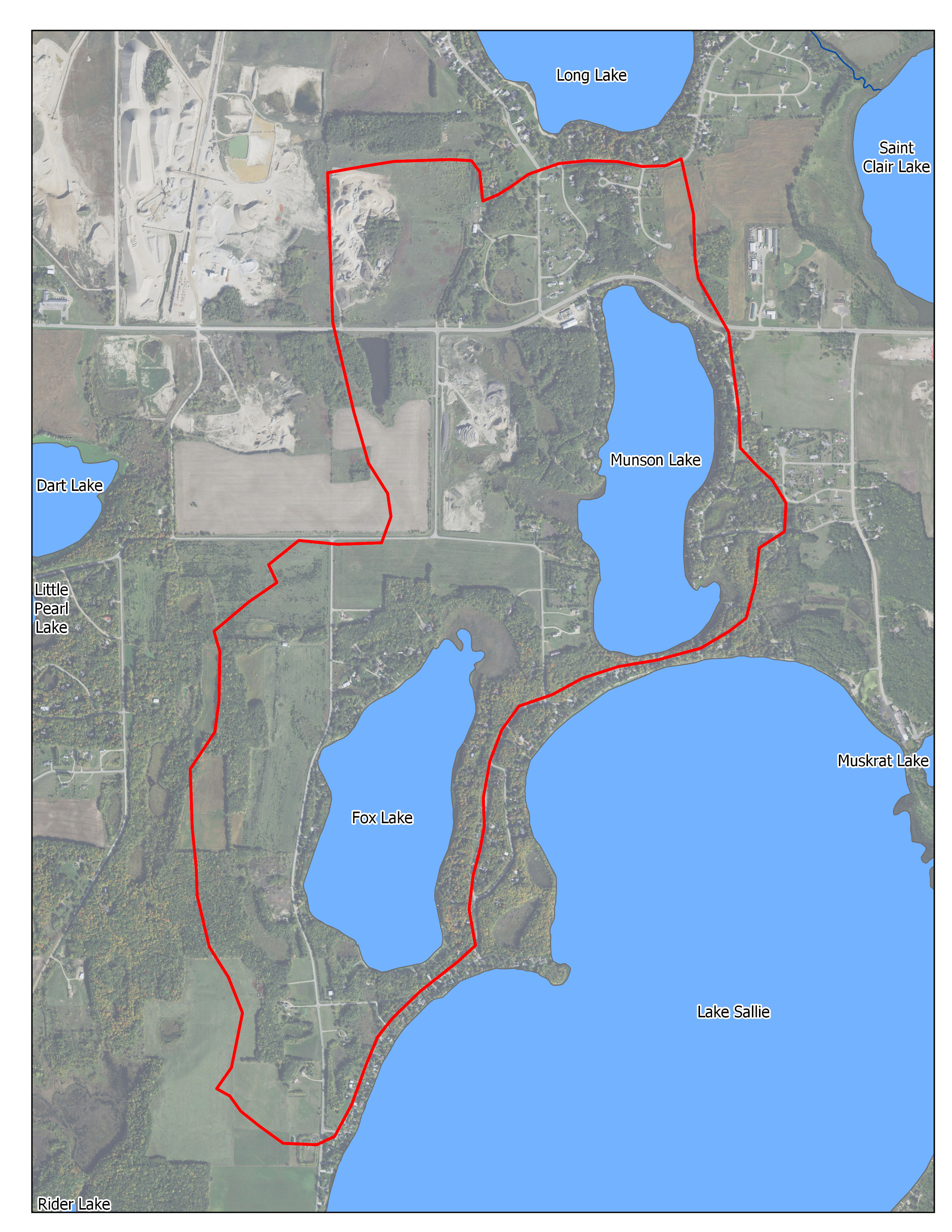
Map
Description & Overview
The Munson-Fox WMA contains about 1,350 acres. The only lakes in this WMA are Munson and Fox Lakes. Both are small lakes, at 129 and 138 acres, respectively, but both are also elongated, giving them good amounts of shoreline. Both lakes are fed by groundwater and have adjacent wetlands and some shoreline runoff, but neither has a significant inlet stream. Both lakes have small outlets. Both Munson and Fox are heavily used for game-fishing, boating and other summer and winter recreational activities. Munson Lake has a public access, and therefore provides recreational opportunities to non- residents as well as residents. Munson and Fox lakes have relatively small watersheds. Some major gravel mining operations are found in the area.
Much of the shoreline around Munson and Fox is heavily developed. There have been extensive modifications to the shorelines as a result of riprap, retaining walls, shore-impact zone structures, and the addition of sand blankets. The occurrence of these shoreline alterations has increased in recent years, as have the number of boats. Given the WMA’s proximity to Detroit Lakes, development is expected to continue on the shorelines and farther from the lakes.
Both Munson and Fox have relatively good water quality and have had stable phosphorus and water clarity readings for the past 10 years. There are no known major upstream phosphorus sources. Shoreland development and agricultural practices surely provide some phosphorus load, and the nutrient load from gravel mining, if any, is not known. In addition, Fox Lake residents have formed a lake association and have expressed interest in helping monitor water quality and other parameters.
Water Quality
Pollutant/Stressor
Phosphorous
Focus
Nearshore
Goals
Protection- Adaptatively manage to protect, enhance, and restore water quality
Actions
- Treat Stormwater discharges through implementation of District Rules
- Manage internal loading
- Identify and protect sensitive aquatic areas
- Conduct shoreline surveys
- Lakeshore protection through implementation of District Rules
- Explore impacts of gravel mining water quality
Water Quantity
Pollutant/Stressor
N/A
Focus
Nearshore
Goals
Promote shoreline resilient to fluctuating water levels
Actions
Promote conversion to naturalized shorelines
Pollutant/Stressor
Insufficient Data
Focus
Insufficient Data
Goals
Ensure sustainable groundwater supply
Actions
Encourage installation of BMP’s that increase infiltration
Ecological Integrity
Pollutant/Stressor
- Climate change
- Transportation of AIS
- Habitat fragmentation and degradation
Focus
- AIS
- Wildlife Habitat
- Fish communities
Goals
- prevent establishment of new invasive species, and manage existing invasive species.
- Protect and improve wildlife habitat in near shore areas
- Maintain healthy fish communities.
Actions
- Develop readiness response
- Monitor access points for new AIS
- Perform periodic aquatic vegetation surveys
- Encourage pollinator friendly seed mixes and plantings
- Identify and protect sensitive aquatic Area