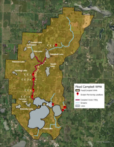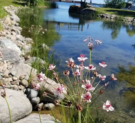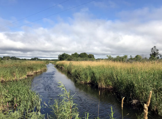
Campbell Creek is an intermittent, high gradient stream and is the major nutrient source to North Floyd Lake. Sections of Campbell Creek were ditched and straightened in the early 1900s for agricultural benefit and included partially drawing down Campbell Lake and draining surrounding wetland areas. Also known as Becker County Ditch 11-12, Campbell Creek drops almost 80 feet in 2 miles before reaching North Floyd. Through the lower reach, Campbell Creek flows through highly erodible soils, and carries a heavy sediment load to North Floyd.
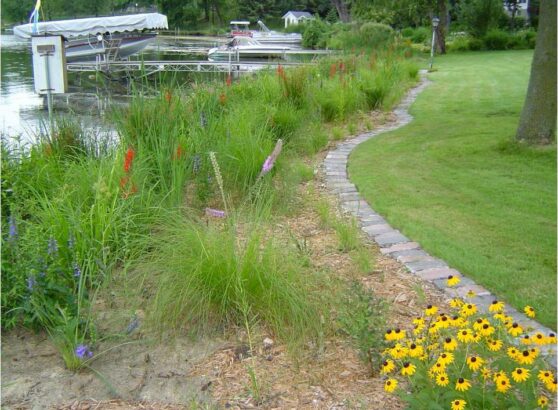
Major issues within the Campbell Creek Watershed Area include stream channelization and bank erosion, runoff from fields, and altered hydrology (drainage). The District has partnered with Becker SWCD to install over 25 agricultural practices in the fields located north and south of 230th Street and streambank vegetated buffers between Campbell Lake and south of 230th Street. PRWD water monitoring showed some reductions in sediment and nutrients, but not enough and more work needs to be done.
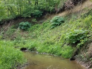
Towards locating stream bank and in-channel erosion areas, in 2020, the MN DNR conducted a stream channel study on Campbell Creek from Campbell Lake to Floyd Lake. The survey identified stream segments that had significant erosion present.
In 2020, Campbell Creek, from Campbell Lake to North Floyd Lake, was listed for sediment (Total Suspended Solids – TSS) impairment (91.2 mg/L). The numeric water quality TSS standard is < 30 mg/L (April – Sept). The overall estimated percent water quality TSS reduction goal is 67%. Overland runoff of sediment and in-stream bank erosion are the greatest contributors of TSS to Campbell Creek and downstream North Floyd Lake. Sediment losses are greatest during the spring, April – June, when vegetation is not yet actively growing, and rainfall is elevated. Campbell Creek is highly susceptible to intermittent flows and has a high erosion potential through agricultural areas where sediment erosion sources may include sheet and rill runoff from upland fields and livestock pasturing in riparian zones. Streambank erosion and stream bed scouring are also major sources of annual TSS loads and is attributable to poor riparian vegetation management near the stream channel and altered hydrology (drainage). Altered hydrology increases stream flows to reduce water storage from tiling and decrease residence time in the stream channel due to straightening.
In the Otter Tail River One Watershed One Plan, (10-year plan adopted in January 2023), Campbell Creek has a short- term phosphorus reduction goal of 45 lbs/year (5% reduction) and a short -term sediment reduction goal (4%) of 126 tons/year. Campbell Creek is 1 of 4 stream reach segments targeted in the plan.
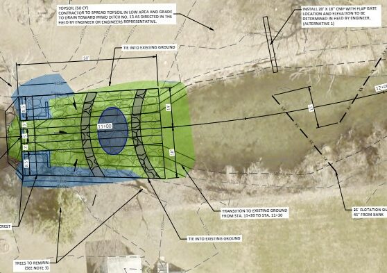
In 2022, the District was selected by the Minnesota Pollution Control Agency (MPCA) to receive a 319 Small Watersheds Focus grant program for the Campbell Creek sub-watershed area that will support long-term comprehensive implementation (four, four-year grant awards that will span a total of 16 years) to address Campbell Creek’s phosphorus and sediment pollution loading issues. These funds will be used to implement a series of projects outlined in the nine-element plan, provide a steady source of funding, focus implementation efforts, and achieve measurable water quality improvements on a specific waterbody. In early 2023, a comprehensive work plan was submitted to the Federal EPA for review and approval. The District will be working with Becker SWCD and the MN DNR to identify and target critical erosion areas and to work with landowners to install needed Ag Best management Practices and streambank stabilization measures.
Click here to view Campbell Creek “Special Studies” reports.